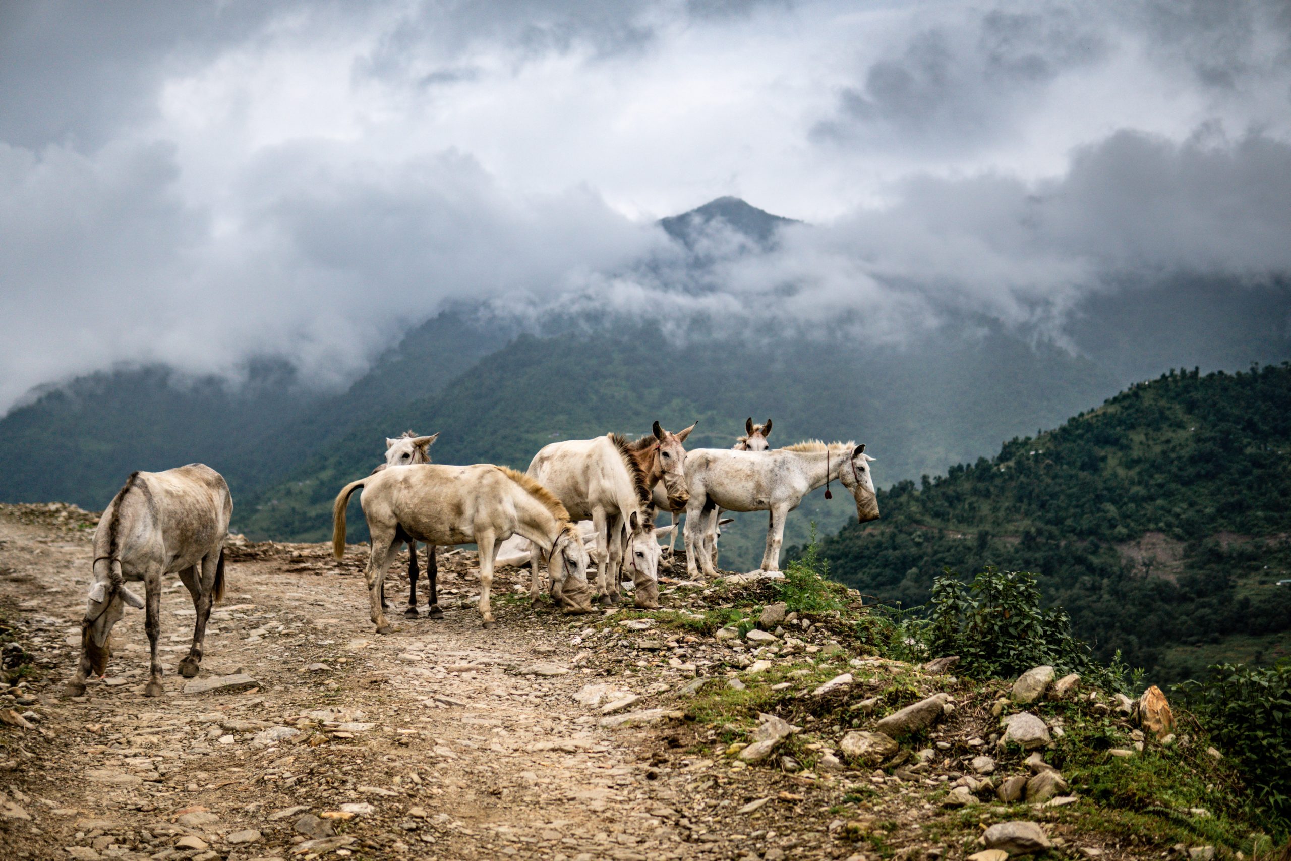
3 nights in Kathmandu, 2 nights Pokhara and 13 days in the Annapurna Circuit Trek. Around Annapurna, in the heart of Annapurna, in the foothills of Annapurna, is mostly done by anticlockwise which begins at Bhulbhule via Besisahar, a town approachable from both Kathmandu (142KM/89 miles) and Pokhara (107KM/67 miles). The trail follows the Marshyangdi river The trail follows the Marshyangdi river upstream, gaining altitude gradually as you travel north through Lamjung district populated mainly by Gurungs. The people of the Annapurnas are our average Himalayan native, their Mongoloid features tinged with Indo-Aryan traits, their religion a mix of Buddhism, Hinduism and animism.
Annapurna Circuit Trek Highlights Include
- One of the 20 things that you should do before die!
- Crossing the world’s highest trekking Pass (ThorungLa -5416M/17765FT), reaching to the world’s highest lake (Tilicho Lake -4949M/12235FT) and trekking through the world’s deepest gorge (Rupse Chhahara -6617M lower from two Himalayan giants; Dhaulagiri and Annapurna)
- Most fascinating and popular trekking routes in the world, taking one through an amazing diversity of terrain and culture; from lush green foothills with pretty terraces and picturesque Gorkha villages to barren, Tibet-like landscape; through deep forested gorges and the high Throung pass, through Buddhist villages with ancient cliff-top lamaseries to settlements that were one great marts of the trans-Himalayan barter trade.
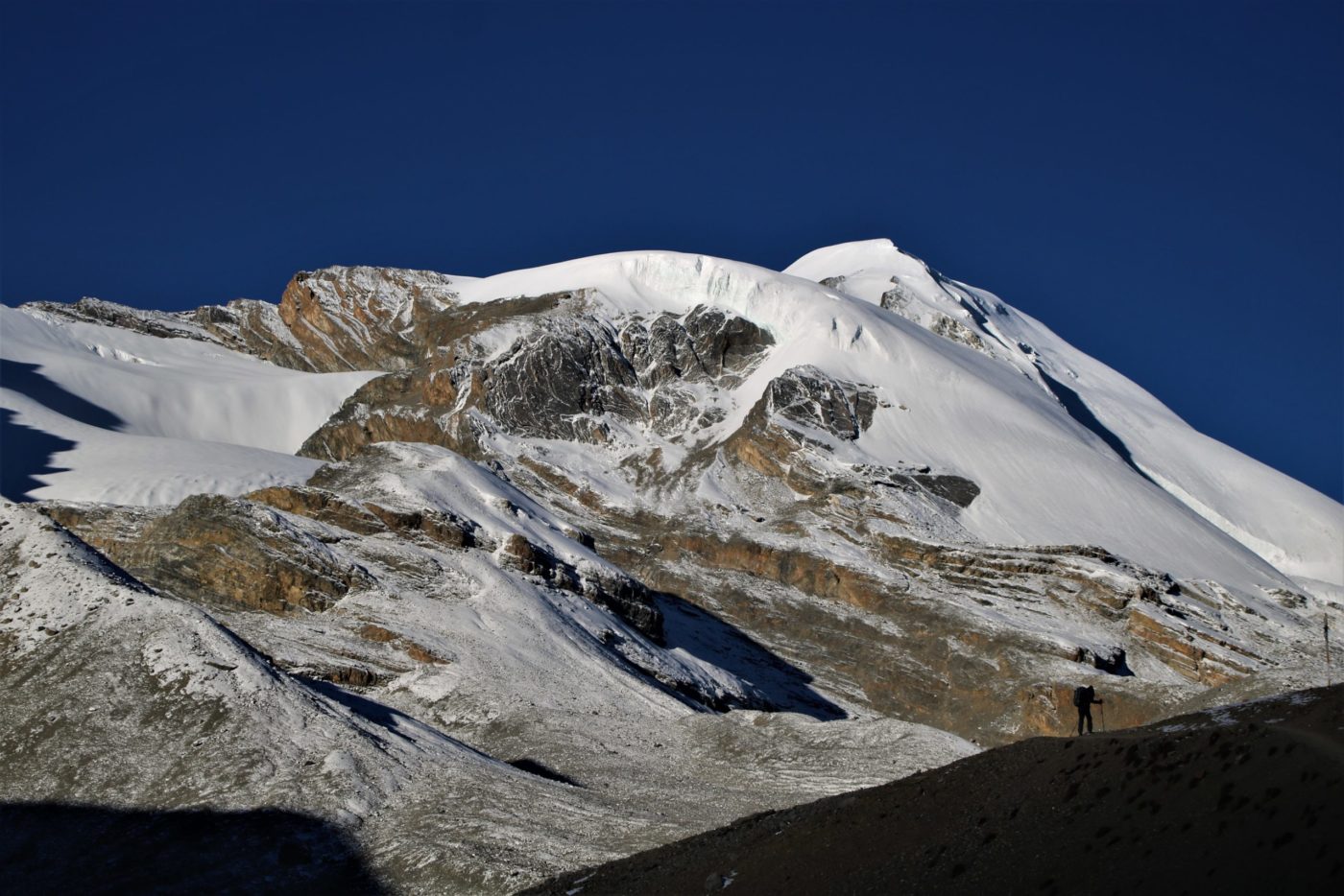
- Close up views of 03 of the 14 eight thousander (8000M+ mountains); Dhaulagiri (8167m –world’s 07th highest), Manaslu (8163M -08th highest), Annapurna I (8091M –world’s 10th highest) as well as five other major peaks; Annapurna II, Annapurna III, Annapurna IV, Annapurna South and Gangapurna. Nilgiri, Machhapuchhre (Fish Tail), Annapurna Fang (Barah Sikhar), Chulu Peaks (East & West) and many other countless peaks!
- Trek would appeal to anyone who is looking for a challenging trek in Annapurna region of Nepal
- Beautiful fir, juniper and rhododendron forests in Annapurna Conservation Area Project (ACAP)
- Walk in a mountainous wilderness, reaching an altitude considerably higher than Mt. Blanc, moving sub-tropical forests to sub-zero temperatures.
Annapurna Circuit Treks Program
Day 1: Arrive to Kathmandu (1300m)
Day 2: Walking Tour of Kathmandu, Trip Preparation
Day 3: Drive to Bhulbhule (840m) Via Besisahar and Khudi, 10 Hrs. Trek to Ngagi (920m), 1 Hr
Day 4: Drive to Chamje (1440m). Trek to Taal (1700m), 5-6 Hrs
Day 5: Trek to Danaque (2300m), 5-6 Hrs
Day 6: Trek to Chame (2730m), 6-7 Hrs
Day 7: Trek to Upper Pisang (3300m), 6-7 Hrs
Day 8: Trek to Ngawal (3657m) Via Ghyaru (3730m), 5-6 Hrs
Day 9: Trek to Manang (3520m), 4-5 Hrs
Day 10: Rest, Acclimatization, Exploration
Day 11: Trek to Churi Letdar (4200m), 5-6 Hrs
Day 12: Trek to Thorung High Camp (4800m), 4-5 Hrs
Day 13: Trek to Muktinath (3800m) Via Crossing Thorung La (5416m), 6-7 Hrs
Day 14: Drive to Tatopani Natural Hot Spring (1160m), 5-6 Hrs
Day 15: Drive to Pokhara (920m), 7-8 Hrs
Day 16: AtPokhara
Day 17: Drive to Kathmandu, 6-7 Hrs
Day 18: Onward Destination
Annapurna Circuit Trek Price Includes
- Welcome at KTM Airport, airport pick up service & transfer to the hotel
- KTM 4 nights 2 stars hotel room with breakfast
- Walking tour around Thamel, local markets of south of Thamel and Swoyambhunath for 3 hrs.
- Annapurna Conservation Are Project (ACAP) Permit fee
- Trekking Permit (TIMS) fee
- Annapurna region experienced government licensed and trained local English speaking guide
- Local people operated room in lodges
- All hot meals on trek as per itinerary order with our hygienic Eco-friendly Outdoor Menu
- Treated drinking water to fill in your bottle
- Camp/dine fire/warm up charge where available
- Guide staff/porter foods, insurance, salary, equipment, transportation & local taxes
- All road transport by public/private vehicle as per itinerary
- Applicable government taxes
- Hotel Domestic airport/bus park-hotel transfers service
- Travel and rescue arrangement support
- Trip crew medical supplies (first aid kit)
- Trip success certificate (case of trip success)
- Airport transfer to KTM Airport by vehicle after trip
Annapurna Circuit Trek Price Excludes
- Your all kinds of insurance
- Visa fees
- Single supplements except solo trip service
- Lunch and evening meals in Kathmandu
- Bar bills and laundry
- Optional trips
- Tips
- All except explained in “PRICE INCLUDES” section above
Acclimatization
Annapurna Circuit Trek program has been designed to complete the Annapurna Circuit trek quickest way possible hence may not prevent Acute Mountain Sickness (AMS). The higher you go the lesser oxygen available. For a safe trek it’s essential to allow sufficient time for acclimatization. Sensible planning is therefore required to minimize the risk of AMS. We advise specially to the guest(s) with heart/ lungs/ blood diseases to consult the doctor before trek because some people can be more susceptible than others. Mild headache, fever, loss of appetite, and stomach disorder are symptoms of AMS. Going up too fast may causes serious illness.
Note
On adventure trek on this type, weather, local politics, transport or a multitude of other factors beyond our control can result in a change of itinerary, it is however, very unlikely that the itinerary would be substantially altered; if alterations are necessary your guide will decide what is the best alternative consulting with you, taking into consideration the best interests of the whole group. Where a change does occur, we do everything we can to minimize its effect, but we cannot be responsible for the results of changes or delays.
The Annapurna range, named after the Hindu goddess of food and harvests, rise in the heart of the Himalayas. They may not be the tallest, but they form the central core of the great Himalayan arc, towering in the very middle of the 2550KM/1550 mile chain that is the planet’s highest mountain range. And being there, they encapsulate the Himalayas, their ridges and prominences, their slopes and foothills typifying the Himaalyan median. The people of the Annapurnas exemplify that median too, they are our average Himalayan native, their Mongoloid features tinged with Indo-Aryan traits, their religion a mix of Buddhism, Hinduism and animism. Around Annapurna, in the heart of Annapurna, in the foothills of Annapurna, is mostly done by anticlockwise which begins at Bhulbhule via Besisahar, a town approachable from both Kathmandu (142KM/89 miles) and Pokhara (107KM/67 miles). The trail follows the Marshyangdi river upstream, gaining altitude gradually as you travel north through Lamjung district populated mainly by Gurungs.
Arrive to Kathmandu
Walking Tour in Kathmandu, 3 Hrs
Drive to Bhulbhule (840m), 10 Hrs Via Besisahar and Khudi, Trek to Ngadi (920m), 1 Hr
Drive to Chamje (1440m), Trek to Taal (1700m), 5-6 Hrs
Trek to Danaque (2300m), 5-6 Hrs
Just ahead of Tal has spectacular waterfall and as we emerge from the settlement and walk ahead, you can’t take our eyes off from maize, barely and potato fields. Soon the hills close in, the valley narrows and we arrive at tiny settlement of Siran Tal -the upper Tal. The slopes are previpitous but the valley widens a bit again after the hamlet of Khotro and to a cluster of huts named Kharte. Beyond Kharte, the trail climbs steadily and we see the houses of Dharapani suddenly. Dharapani means water tap and it is where travellers in the olden days stopped to collect water for the hourney ahead. Opposite Dharapani, on the east bank, thunders an awesome waterfall, bringing the waters of the Dana Khola, fed by the Tulagi glacier of the Manaslu range, to the marsyangdi. Farther opposite from the third clusters of hotels is the village of Thonje, is situated at the confluence of the Dudh Khola and the Marshyangdi which is junction for the trekkers who come down after finishing Manaslu circuitt on their way back to Besi Sahar. It is a large village with Gompa and a Hindu shrine. During the Tibetan salt trade days, merchants stocked their goods here in late autumn and waited out the winter. It was from here that the trade route left the Marshyangdi valley to follow the Dudh Koshi into Larkya Pass and beyond. The trail continues along the right bank of Marsyangdi as we leave Dharapani, climbing gently through a forest of pine and oak and a stone stairway leads up to the Kani, village gateway of Bagarchhap. The village marks the end of the great marsyangdi gorge and now, again, the snowy mountains of Annapurna II, IV and Lamjung Himal are on the scene. Over half an hour up a forested slope, Danaque is already there.
Trek to Chame (2730m), 6-7 Hrs
Trek to Upper Pisang (3300m), 6-7 Hrs
Trek to Ngawal (3657m) Via Ghyaru (3730), 5-6 Hrs
Trek to Manang (3520m), 4-5 Hrs
Rest, Acclimatization, Exploration Day
Trek to Churi Letdar (4200m), 5-6 Hrs
Trek to Thorung High Camp (4800m), 4-5 Hrs
Trek to Muktinath (3800m) Via Crossing Thorung La (5416m), 6-7 Hrs
Drive to Tatopani Natural Hot Spring (1160m), 5-6 Hrs
Drive to Pokhara (820m), 7-8 Hrs)
At Pokhara
Drive to Kathmandu, 7-8 Hrs
Onward Destination
Tour Reviews
There are no reviews yet.
Leave a Review